

For this church: |
Sutton-in-Ashfield St ModwenLocationLocator MapsApproximate Site of St Modwen’s Church (1937 to 1991)
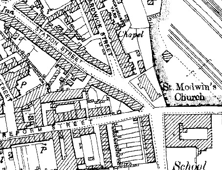
Maps showing locations of earlier Mission Churches
|

Map from the 1890s |
Map of 1938, showing the later Mission Church |
|
 |
 |
Maps from Edina, Historic Digimap © Crown Copyright and Landmark Information Group Limited (2012). All rights reserved.
![]()
Introduction | Location | History | Archaeology | Contacts
Fittings | Glass | Organ | Bells | Clock | Stonework | Monuments | War Memorial | Churchyard
References | Pictures | Plans | List of Incumbents
Project: Home | Index | About | People | What's new | Resources
![]()
 |  |  |  |