For this church:    |
|
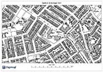
 OS map from 1882 OS map from 1882 |
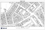
 OS map from 1901 OS map from 1901 |
 OS map from 1968 OS map from 1968© Crown Copyright and Database Right 2015. Ordnance Survey (Digimap Licence) |
Prior to construction of the church the site was occupied by cottages fronting Alfreton Road.
Little site investigation work must have been undertaken before the building work commenced other than demolition of the buildings depicted on the 1882 Ordnance Survey map, which probably only had shallow foundations. This is perhaps why it was necessary to excavate the foundation trenches to a depth of nine feet, due to the loose sandy nature of the ground. This additional time-consuming and expensive work might have been one of the reasons why the church was never completed to the architect’s original plan.
The architects were Habershaw and Fawckner of Newport. The church’s design was stated as being ‘decorative of the 13th century’ with a nave of seven bays and side aisles, and a chancel with square tower topped by a spire on the north side, which also housed an impressive north door into the entrance in its base leading into the north aisle. A three-sided vestry tucked into the corner between the tower base and the north wall of the chancel gave access to the north side of the chancel; this too had an external door. On the south side of the chancel balancing the north tower and vestry was the organ chamber and another vestry with an access door. A further porch and entrance was located on the south-east wall. At the west end of the nave a narthex spanning almost the width of the wall was included.
Had it been possible to build the church to those plans, it would have been truly impressive, but it was not to be. After building work had stumbled on for three years, it was brought to an end in 1902, only partially completed in an economic fashion. Of the uncompleted work, the most significant was the reduction of the nave, arcading to just three bays and without a grand west end narthex or spire to top the tower.
Exterior
The material for construction was local Bulwell stone for the exterior, with Bath stone for all the exterior dressing and decorative work. The roof was covered with Welsh slate.
Windows
East – five tall lancets with the centre light slightly taller than the outer pairs, each of which supported a six petal roundel; the apex was filled with a large eight-petal rose. The same design was used for the west window.
In the base of the tower, three single lancet lights were set between the buttresses. Also in the tower base there was a short single lancet light over the porch plus two small lights set on the north-west corner.
Due to the paucity of visual evidence it is not possible to describe the window tracery in the north and south aisles, other than to say the original plans show them set between buttresses.
Interior
No images of the interior were located. Internally the walls were finished with red Nottingham bricks with black brick bandings, all pointed with black mortar. The arcade piers and arches were of Bath stone. The floor covering of the aisle was oak blocks and in the chancel and sacristy, encaustic tiles were used. Over the nave there was a Hammer Beam roof with graded principals, whilst the chancel was covered with a Wagon roof.
|
On plan |
Actual |
Nave – length |
110 ft |
45 ft |
Side aisles – 2 – width |
15ft |
|
Nave – width |
31 ft |
|
Height to wall plate |
37 ft |
|
Chancel – length |
45 ft |
|
Chancel – width |
31 ft |
|
Tower – square |
12 ft |
|
Wall of tower base |
4 ft thick |
|
Organ chamber |
15 ft 3 ins x 14ft 6 ins |
|
South vestry |
12 ft x 12 ft |
|
Other site information
In 1884 a Mission Hall was erected on the north-western section of the site. It was a substantial structure, only slightly longer and narrower than the completed length of St Michael’s. It was almost as high and had a clerestory and side aisles. It was used by the church as a church hall. Whether it was demolished at the same time as the church or earlier is not recorded, but it may be the 'Sports and Social Club' marked on the 1968 Ordnance Survey map.
A wood and corrugated iron building was erected in the south-west of the site, specifically for use as ‘the girl’s lavatory and closet’. No toilet provision for males is recorded.
The area to the west of the church which would have been used for the larger planned scheme was at one time used as a tennis court and bowling green.
Technical Summary
Timbers and roofs
| NAVE | CHANCEL | TOWER | |
| Main | Hammer Beam roof with graded principals, probably 1888-9 | Wagon roof, probably 1888-9 | Unknown |
| S.Aisle | Not known. | n/a | n/a |
| N.Aisle | Not known. | n/a | n/a |
| Other principal | |||
| Other timbers |
Bellframe
Unknown design.
Demolished.
Walls
| NAVE | CHANCEL | TOWER | |
| Plaster covering & date | No plaster, red brick with black brick bandings, all pointed with black mortar, c.1888-9. | Probably as nave. | n/a |
| Potential for wall paintings | None known previously | None known previously |
Excavations and potential for survival of below-ground archaeology
No known modern archaeological excavation has been undertaken on the site of this church.
The entire building was constructed anew in 1884-9 on the site several small cottages. The churchyard was roughly rectangular N-S, and the western part of the site was occupied by a Mission Hall. The entrances were off Alfreton Road and the former Outgang Lane and there was a path linking the two which extended N.W. to the Mission Hall. The site of the church has been redeveloped and is largely occupied by a modern college building (in 2015), although a small portion of the eastern part of the site is maintained grass and trees.
The overall potential for the survival of below-ground archaeology on the former church site and former churchyard, is considered to be LOW comprising mainly destruction layers from the 1884-9 church, construction layers of modern buildings, and below this perhaps evidence of previous use of the site, though this is expected to be fragmentary at best. The archaeology in the western portion of the site may well be entirely obliterated by modern development.


