For this church:    |
|
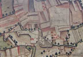
 Section of 1635 plan Section of 1635 plan(Click for larger version) |
Historically the chapel has stood in a field which either in its entirety or in part has been identified from at least 1635 as ‘Chapel Yard’. In 1873 the Archdeacon of Nottingham stated categorically, while seeking to define the extent of the area belonging to the chapel in order to resolve variations between the depiction of Chapel Yard on the Tithe Map of 1839 and the Enclosure Map of 1860, ‘That the Ground has not been used for Interment within the Memory of Man’. The chapel was then narrowly enclosed by fencing, that is still evident on OS maps in 1887 but had disappeared by 1900 as had most stone boundary markers by the 1930s. A concrete path currently leads to the south porch doorway across part of the field in which the chapel stands. In its present form, this was laid at the instruction of the Rev Richard Camenisch in the 1980s. It is fenced off with a wooden swing gate and iron railings to prevent the entry of animals into the chapel.


