

For this church: |
Nottingham St AnnChurchyard
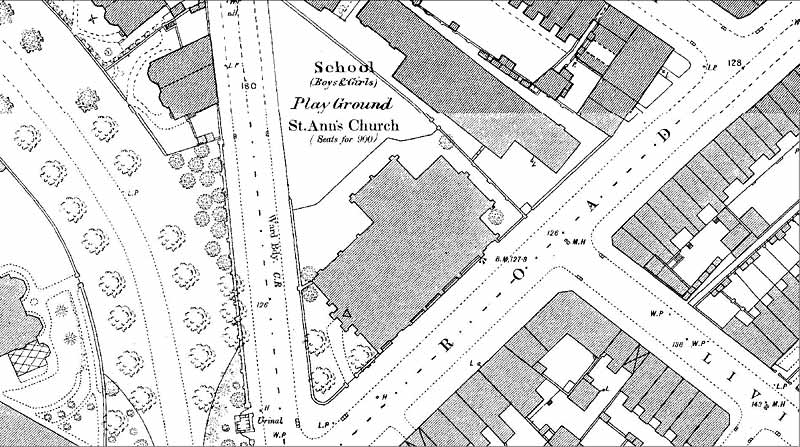
The churchyard was very small and lozenge shaped, formed from the angles between St Ann's Well Road and the adjoining road. The 1882 OS map shows a few trees to the west side, flanking the path to the entrance; two further trees were also located at the east. The boundaries were walls with iron railings and iron gates, but to the north a probable fence apparently originally separated the churchyard from the adjacent school playground. There were no burials. |
![]()
Introduction | Location | History | Archaeology
Fittings | Glass | Organ | Bells | Clock | Monuments | War Memorial | Churchyard
References | Pictures | Plans | List of Incumbents
Project: Home | Index | About | People | What's new | Resources
![]()
 |  |  |  |