 Nottingham Nottingham
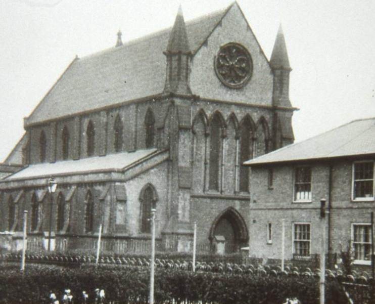
St John the Baptist
Churchyard
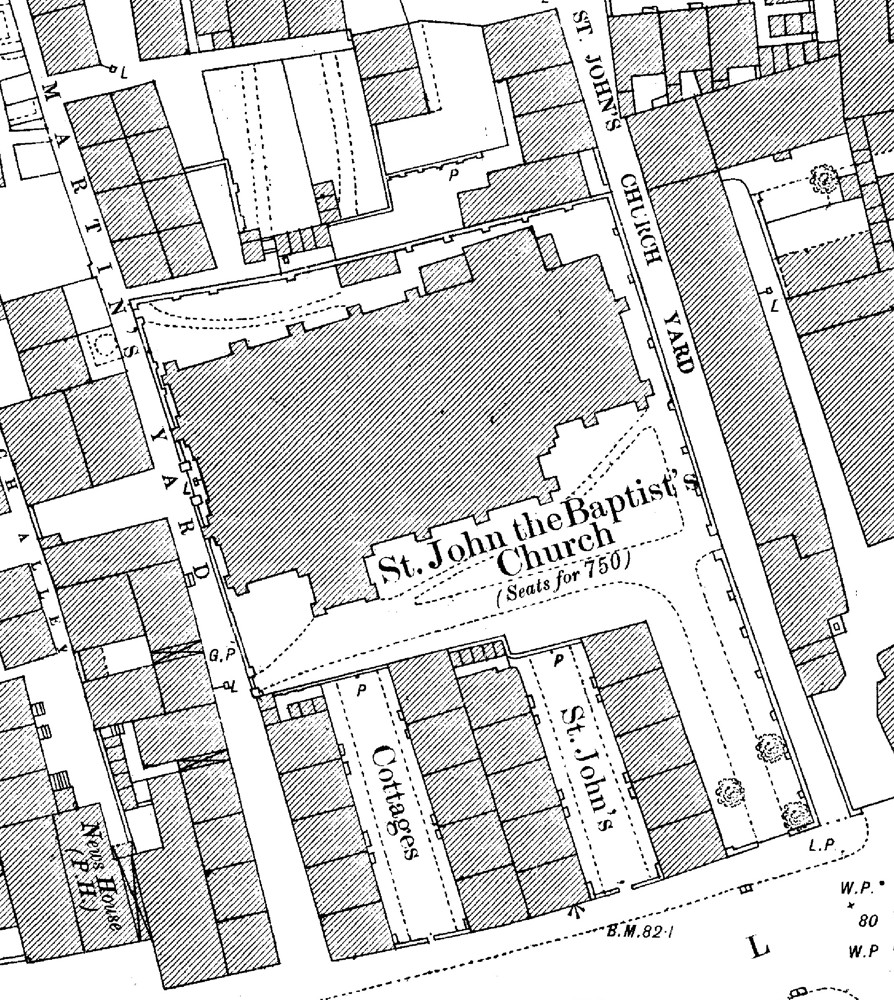
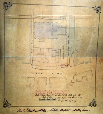
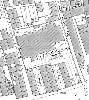
There was no churchyard as such, but from plans it would appear that a narrow lane to the east side of the church was called ‘Saint John’s Church Yard’. The church was surrounded in part by a low wall (certainly on the north side). The main entrance was from the south and a small open area existed to the south, with a path running to the south porch. On the north side a much smaller open area existed, with evidence of vegetation, and on the 1882 OS map there is a path leading from a gate at the north-west corner of the churchyard to a small building of unknown function against the north wall. On the same map, a gate is also shown leading from Martin’s Yard at the south-west corner along a path to the south porch, and it appears that there was a main west doorway to the church leading directly onto Martin’s Yard. Three trees are shown by the main south gate onto Leen Side. To the east and west, the church building lay hard by the surrounding walls. On the 1901 OS map another building, also of unknown function, is shown just to the south-east of the church.
Site plan |
|
Section of OS mep from1882 |
 |
|
 |
| |
|
Map from Edina, Historic Digimap © Crown
Copyright and Landmark Information Group
Limited (2012). All rights reserved. |
Click either for larger version.
|