

For this church: |
Nottingham St John the BaptistLocationLocator MapsApproximate loacation of the site of the former St John’s Church
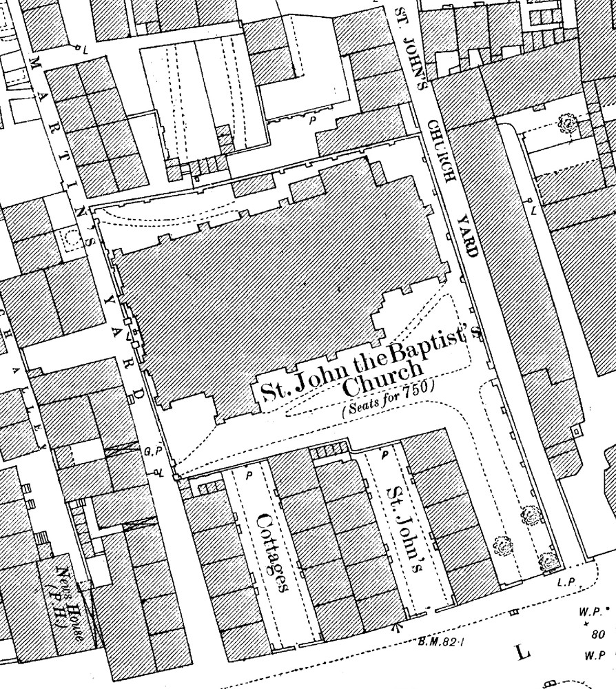
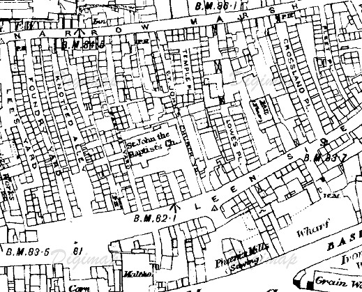
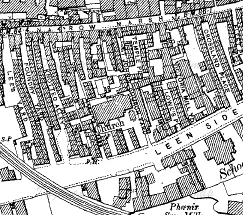
Sections of Old Ordnance Survey maps showing the ChurchClick each map for larger versions
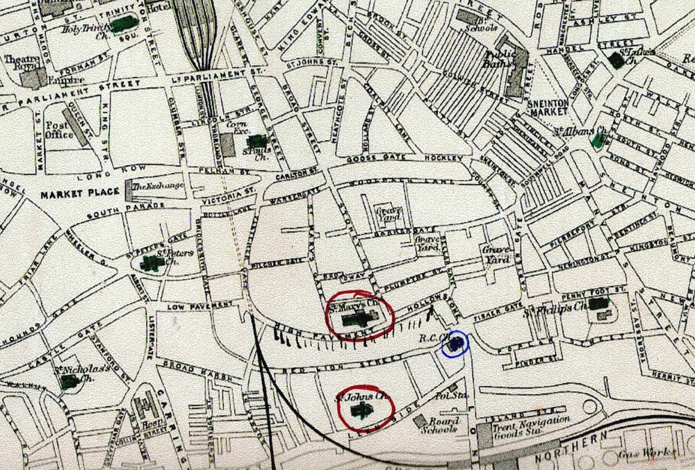
Maps from Edina, Historic Digimap © Crown Copyright and Landmark Information Group Limited (2012). All rights reserved.Map of Nottingham City CentreShowing the proximity of many city churches, especially St Mary’s and St John’s
|


![]()
Introduction | Location | History | Archaeology | Contacts
Fittings | Glass | Organ | Bells | Clock | Stonework | Monuments | War Memorial | Churchyard
References | Pictures | Plans | List of Incumbents
Project: Home | Index | About | People | What's new | Resources
![]()
 |  |  |  |