

For this church: |
Annesley Old ChurchLocationLocator Maps
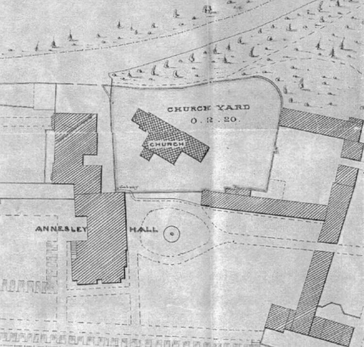
Plan of the Church and Hall dating from 1873
This plan (click here for larger version), showing Annesley Hall, the Gatehouse Range with Stables, Carriage Yard and Bakehouse, is dated 1873 and is reproduced by permission of Nottinghamshire Archives. The Church is built on a mound and thus is elevated above all the other buildings shown. The Tower is at the upper left on the plan, with the chancel at the lower right and the entrance porch at the bottom left. People from the “Big House” entered the churchyard via a flight of steps situated near the carriage turning-circle, whilst other churchgoers used a woodland path from the road and a (just discernible) gate in the wall. |

![]()
Introduction | Location | History | Archaeology
Fittings | Glass | Organ | Bells | Clock | Stonework | Monuments | Churchyard
References | Pictures | Plans | Listing Description | List of Incumbents
Project: Home | Index | About | People | What's new | Resources
![]()
 |  |  |  |