

For this church: |
| ||||
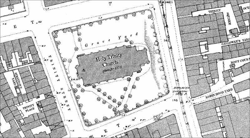 1882 OS map 1882 OS map |
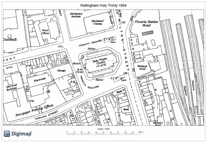 1954 OS map 1954 OS map |
© Crown Copyright and Database Right 2015. |
|
The 1:500 Ordnance Survey map of 1882 shows paths from the southern entrance, which had steps, lined with trees and further trees around the periphery. The north-west entrance also had steps and a path.
A document dated 1898 shows that Trinity Church received a payment of £6,500 for 2,238 square yards of land purchased via the Nottingham Improvement Act 1898. This land was used to set out Trinity Square. In 1919 a further considerable area of the churchyard was sold to Nottingham Corporation (see site plan) for the sum of £13,070. This document is signed by Albert Ball, the then Mayor of Nottingham and the father of Albert Ball VC. This considerably reduced burial space. There are no records regarding the removal of graves or memorials except a note stating that the remains were respectfully removed.
The single entrance to the churchyard was located in the north-west corner of the site. A gateway on the south side was lost at the time of the 1919 land purchase.
With comparatively small areas for land between the church building and the reduced boundary walls large scale parish burials were not feasible, but a limited number did take place. Among the church records there is a document recording details of the dimensions for a brick vault. Unfortunately it is not dated. The internal specification of the brickwork is given as 6 feet 9 inches long x 2 feet six inches wide, with a depth of not less than 10 feet. The brick was to rise above ground level and to be capped with a flat top stone size 7 feet 6 inches long x 3 feet 3 inches wide.
The graves were opened and the interred remains removed after the church had been demolished. There is no record of where the remains were reburied. The most likely place would have been the Municipal Cemetery at Wilford Hill. It is likely that the majority of parish burials in the 19th century would have taken place in the burial grounds operated by St. Mary’s Church.
There are burial registers held with other records in the Nottinghamshire Archives Office, plus a short list of some of the burials with names and addresses of persons interred 1844-1936.
A plan attached to the conveyance transferring the site to the City of Nottingham prior to the demolition of the church in 1958 gives the area of the site as 1,787 square yards or thereabouts.
![]()
Introduction | Location | History | Archaeology
Fittings | Glass | Organ | Bells | Clock | Monuments | War Memorial | Churchyard
References | Pictures | Plans | List of Incumbents
Project: Home | Index | About | People | What's new | Resources
![]()
 |  |  |  |